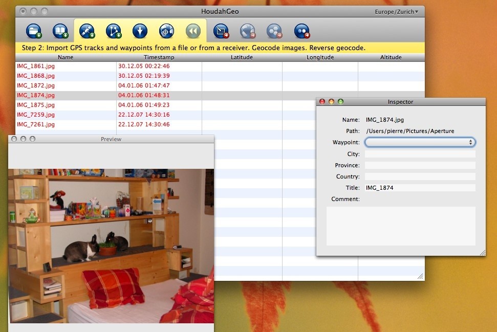
HoudahGeo is a really cool geocoding software for the Mac. With HoudahGeo you may "pin" photos to the locations where they were taken.
The thus created information may be exported to EXIF tags as well as to Google Earth KML files. Such a file allows for browsing your photos within Google Earth.
You don`t need a digital camera with a built-in GPS. You need HoudahGeo, a Mac software solution for geocoding photos with latitude, longitude and altitude information.
HoudahGeo provides the same functionality as a GPS camera, but without having to deal with the bulk or the expense. And - for less money - HoudahGeo does a lot more...
You don`t need a GPS device. HoudahGeo may operate in a fully automatic mode when provided a track log file from a GPS receiver. Finer control is possible by attaching photos to waypoints created using a GPS device.
When no GPS device is available, manual geocoding is possible through integration with the Google Maps service.
Here are some key features of "HoudahGeo":
· Automatic geocoding from a GPX or NMEA track logs.
· GPX download from many USB based GPS devices.
· Manual geocoding from GPX way points.
· Manual geocoding using Google Maps.
· EXIF image file tagging.
· Google Earth export.
· Flickr upload.
Requirements:
· A digital camera.
· Optionally a GPS device.
Limitations:
· Export functions are limited to 5 images per project.
What`s New in This Release: [ read full changelog ]
· Bug fix: Lion compatibility - HoudahGeo 2.9 brings several fixes for compatibility with Mac OS X 10.7 Lion.
· Enhancement: iPhoto media access - Support for iPhoto libraries which reference images located on external drives.